In 1993, Crossman Engineering added a land surveying division to improve control of schedules and quality of finished products. Crossman Engineering has gained a reputation for providing responsive and precise land surveying services and utilizes progressive field and office survey equipment, and computer-aided design.
We are licensed to practice land surveying in Rhode Island and Massachusetts. Our field crews and office technicians have extensive experience with the latest equipment and technology. In the field, Crossman Engineering uses high accuracy equipment, including LEICA Total Stations with Carlson Data Collectors and software and LEICA G series GPS systems. In the office we use AutoCAD, Civil 3D and LEICA Geo-Office Software.
Land surveying services provided by Crossman Engineering, include the following:

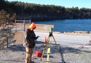
Surveying on the Gainer Dam, Scituate, RI.
- ALTA/ACSM Land Title Surveys
- Boundary Surveys
- Construction Layout
- Easement Surveys
- Land Court Surveys
- Right-of-Way Corridor Surveys
- State Highway Condemnation Surveys
- Existing Condition Surveys
- Topographic Surveys
- Utility Compilations
- Subdivision Plat Plans
- Condominium Documents

